
| Volume | 2 |
| Page | 930 |
| Type | Ab. |
| Lvl I | Pr. |
| Prov | Ostpr. |
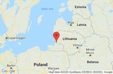
| RB | Gumbinnen |
| Kr | Heydekrug |
| See | Paleiten |
Type Ab. - Tattamischken is a Abbau (Surface Mine).
Lvl I Pr. - Level I shows which Kingdom or State the place is located in. Tattamischken is located in Preussen.
Prov Ostpr. - The Province shows which Province or State the place is located in. Tattamischken is located in Ostpreussen.
RB Gumbinnen - The Regierungsbezirk for Tattamischken is Gumbinnen. The Regierungsbezirk is a government district that is in hierarchy between the State and Kreis level.
Kr Heydekrug - The Kreis for Tattamischken is Heydekrug. A Kreis is a government district (similar to a U.S. county).
See Paleiten - A See notation means the entry is dependent on another entry. In this case, Tattamischken is dependent on Paleiten, which should be consulted for additional information.
The Catholic Parish is Schillgallen
The Protestant Parish is Paleiten
*Source: Family Search
The list below are those places from the Meyers Gazetteer that are nearby to Tattamischken
(which may include itself) and are listed as containing a Catholic Church or Parish,
a Protestant Church or Parish, a Synagogue, or Other Church.
| Place | Distance (~miles) | Catholic | Protestant | Jewish | Other | ||
|---|---|---|---|---|---|---|---|
| Parishes | Churches | Parishes | Churches | Synagogues | |||